
Our Pirnmill Hills Hike
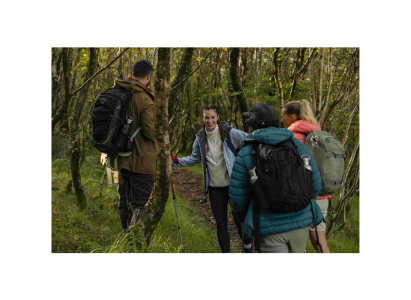
The start of the route takes you from the waterside up through some woodland, once the route opens out don’t forget to keep looking back, the view over the water is beautiful. The path takes you along side the river and then over it, offering chance for a quick splash if it is getting warm.
From there it is a steep climb up to the first summit where we took the opportunity to take a bite to eat as a reward for that incline.
The route then undulates along the ridge line taking you round to the next summit which offers incredible 360 views of the surrounding areas, including Goat Fell.
The final rocky trig offered a moment for refreshments, celebration and for reflection, such an amazing hike with incredible views, then time to start heading back down. The route back down the coast is equally stunning, passing Coire- Fhionn Lochan lake which reflected the mountains.
Once back down at the waters edge we couldn’t resist the opportunity for a swim and to cool off our tiered feet.
Overall a challenging hike but highly rewarding with the views, the mountains on Arran are incredible and well worth the effort.
You end up back crossing the ford over Corrie Burn spring and re-joining your start path for the last 30 minutes before you reach the car park.
You can learn more about the route via our Kamoot page, scan the QR code at the top of the page of click on the link here to download the GPX route.